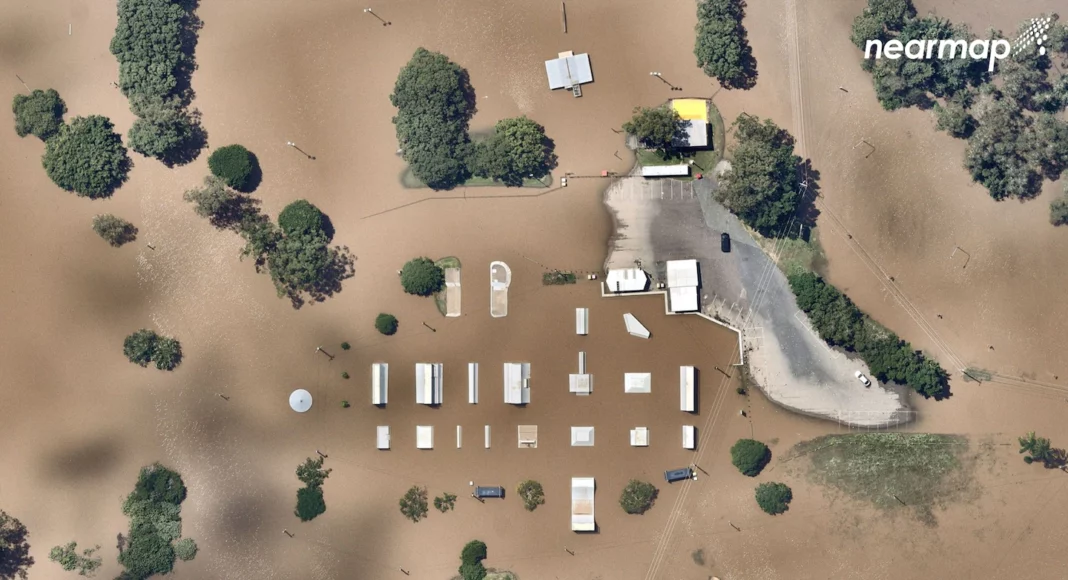
Australia’s Bureau of Meteorology said flood impacts were expected to continue through Thursday across southeast Queensland and New South Wales, as multiple flood warnings remain. Severe thunderstorms in Queensland are expected to move into the southwest region of the state by the weekend.
For many locations, the recent flooding was a once-in-a-lifetime event, as rainfall totals set records. Sydney had its wettest 16-day period on record, accumulating 24 inches from Feb. 22 to Wednesday. Rain filled creeks and rivers, which brought soil and mud to Sydney waterways.
Brisbane set a new three-day record, receiving 26 inches from Feb. 25 to Feb. 28. The probability of so much rainfall in Brisbane within 72 hours is just between 0.5 and 0.2 percent in any given year. Brisbane also set a new weekly rainfall record of 31 inches, the highest observed since records began in 1840.
The village of Dunoon received the second-highest daily rainfall ever recorded in New South Wales, at 30 inches in 24 hours on Feb. 28.
The small rural town of Doon Doon in New South Wales received 41 inches in 48 hours, which is calculated to be greater than a 1-in-1,000-year event (meaning there is only a 0.1 to 0.05 percent chance of it occurring in any given year).
In many regions, rivers also flowed out of their banks to record levels. The Wilsons River at Lismore reached 46.6 feet on Feb. 28 — eclipsing the previous record from 1954 by 6.5 feet.
These flood monitoring cameras demonstrate the extent of the rainfall and just how quickly waters rose, causing major damage during the recent #seqfloods 😮 pic.twitter.com/56CnQfuHp0
— Queensland Reconstruction Authority (@QReconstruction) March 8, 2022
Since November, the Bureau of Meteorology declared that the nation was under a La Niña weather pattern. La Niña, which is characterized by cooler waters in the central eastern tropical Pacific, can affect weather patterns around the world.
Story continues below advertisement
In eastern and northern Australia, La Niña typically results in above-average rainfall during winter and spring. In fact, the six wettest winter and spring periods in eastern Australia all occurred during La Niña years. Also during a La Niña, the average December-to-March rainfall in eastern Australia is 20 percent higher than the long-term average. The 2010-2011 devastating floods in Queensland took place during a La Niña.
However, the region isn’t just affected by La Niña at the moment, said Chiara Holgate, a postdoctoral research fellow with the Australian National University and ARC Centre of Excellence for Climate Extremes.
Another climate oscillation known as the Southern Annular Mode (SAM) can also affect rainfall in southern Australia. SAM refers to the north and south movements of westerly winds in the Southern Ocean, circling Antarctica. Changes in the position of the wind belt can affect the strength and location of cold fronts and storm systems at mid-latitudes, according to the Bureau of Meteorology.
Story continues below advertisement
During Australia’s summer, a positive SAM — as currently stands — can result in more easterly winds bringing moist air from the Tasman Sea towards southern Australia. As the winds hit the coast, the moisture can fall as rain.
“Australia is most impacted by the combination of La Niña with the positive phase of the Southern Annular Mode (SAM). This combination is happening right now,” wrote Holgate in an email. “When La Niña and positive SAM team up, they reinforce each other’s role to funnel large quantities of moisture from the Pacific Ocean into eastern Australia, where it can form rain more easily than usual.”
Over the past five months, eastern Australia has experienced a series of intense rainfall events. November marked Australia’s rainiest November since records began in 1900, with the national average 135 percent above the long-term average.
Story continues below advertisement
While La Niña and SAM are natural phenomena, researchers say climate change can still play a role in the extreme flooding. As global temperatures rise and the atmosphere warms, water molecules more readily evaporate and enter the vapor phase — making water more available for storms to draw from.
“Our climate and streamflow are highly variable, with many different drivers of this variability including the El Nino and La Nina cycle. The effects of climate change will be superimposed on this natural variability,” wrote Francis Chiew, a senior hydrologist at Australia’s Commonwealth Scientific and Industrial Research Organization, in media release.
Chiew said determining how much of this instance of extreme flooding can be attributed to climate change will take more time to analyze, considering there are a number of other factors that can exacerbate rainfall and flooding. However, he stated that “we know that under a warmer climate, flood risk in general is likely to increase.”


